
PADUKUHAN BORO
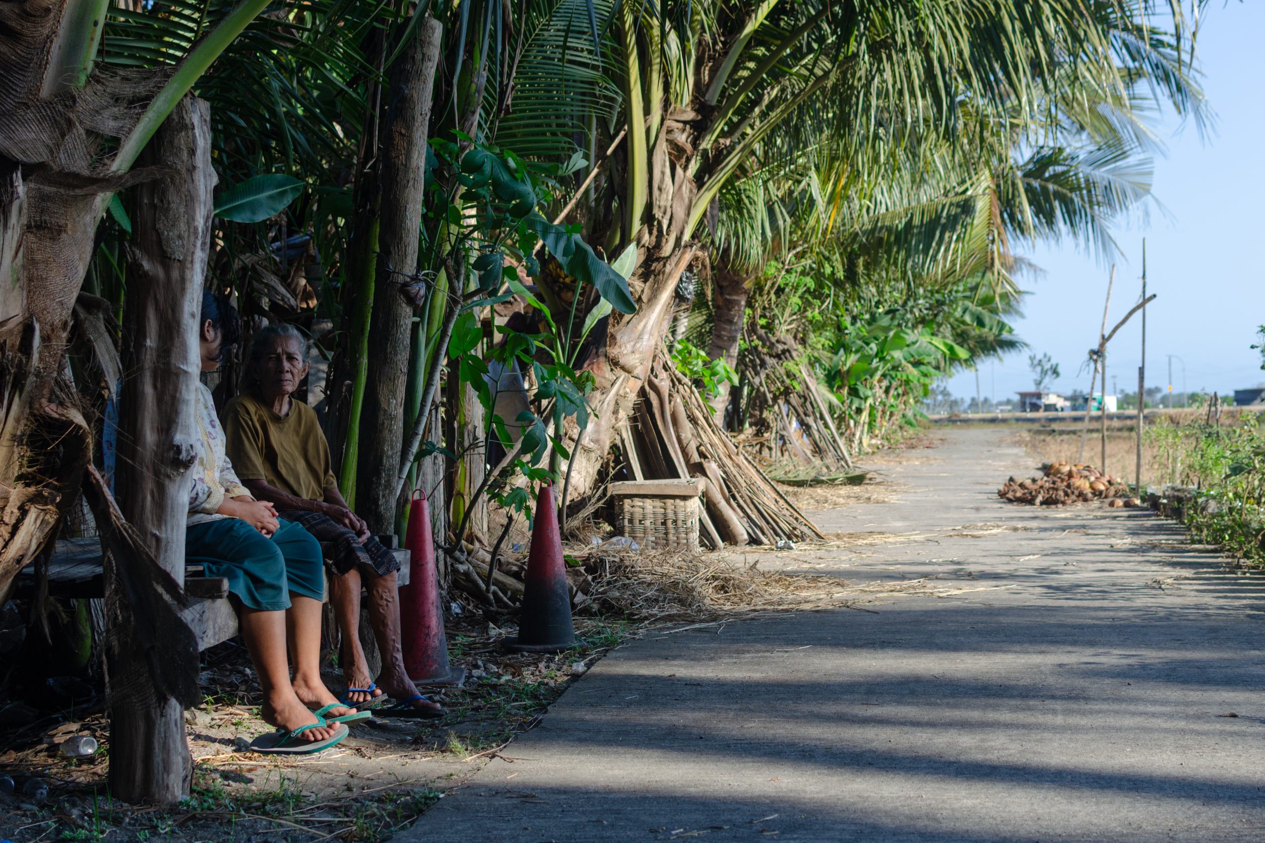
Boro II is one of the hamlets (Padukuhan) in the village of Karangsewu, located in the Galur Subdistrict, Kulon Progo. The hamlet comprises four neighborhood units (RT). Geographically surrounded by rice fields, Boro II resembles an island encircled by a sea. This imagery stems from its origin as part of Karang Kemuning, a region once dominated by swamps where boats were the main mode of transportation for residents. Over time, these swamps were drained and converted into productive land and residential areas. The name Karang Kemuning was later changed to Adi (noble) Karto (fertile), and eventually the area was incorporated into the larger Kulon Progo region.
Due to its surrounding rice fields, most residents of Padukuhan Boro II work as farmers. During the rainy season, they cultivate rice, while in the dry season, they switch to planting secondary crops (palawija). In addition to farming, many women work as chili pickers (daily agricultural laborers) on other people’s lands, while many men work as construction laborers.
To the north of the rice fields lies a main road connecting Kulon Progo and the city of Yogyakarta—approximately 30 kilometers away from the city’s Kilometer Zero point. To the south lies the Southern Cross Road (JLS), which leads to the Pandansimo Bridge—a popular gathering and picnic spot for young people. Not far to the west is the Deandels South Coast Road, which provides access to the New Yogyakarta International Airport (NYIA).
Despite being surrounded by such infrastructure, Padukuhan Boro II remains relatively quiet and experiences minimal social interaction. The nature of the residents’ work—stretching from early morning to evening—results in tightly packed daily routines. During mid-day rest hours, most people either pray or rest at home before resuming work, or simply remain indoors for the evening. This quiet atmosphere is further accentuated by abandoned houses overgrown with vegetation, poor lighting, and the absence of social gathering spaces for casual conversations (jagongan).
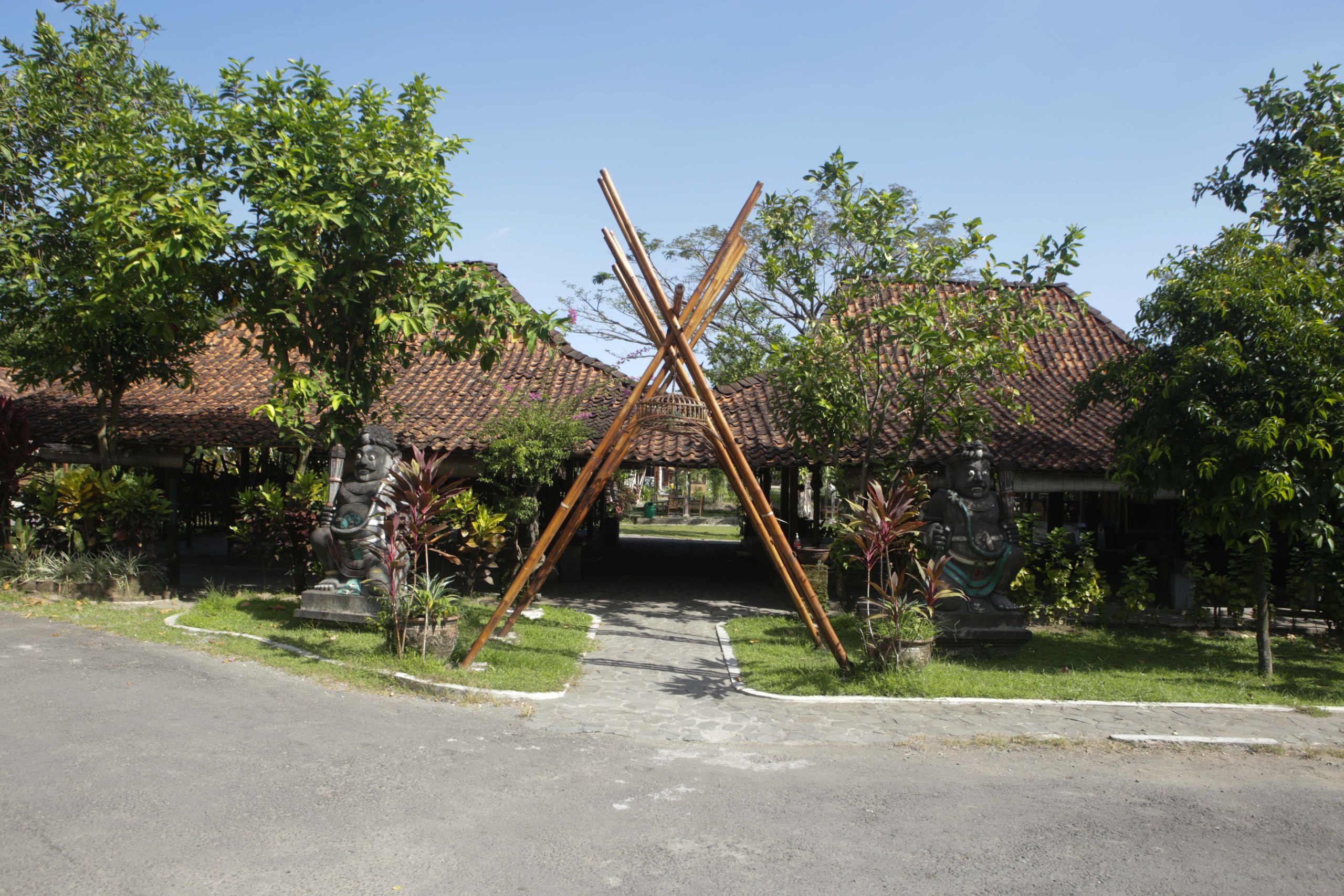
However, this surrounding mobility infrastructure does exert indirect influence. For instance, some houses in Padukuhan Boro II feature a blend of urban-style facades combined with the simplicity of rural architecture on the sides and rear of the buildings. Some homes also have fences, though they are largely non-functional—meant neither to obstruct views nor restrict access—highlighting a blend of closed-off urban architectural styles and open rural ones.
In addition to its architectural uniqueness, the hamlet is also home to several historically significant graves. One example is the grave of Simbah Kyai Ghuro, considered a sacred site, and another is the grave of Simbah Kyai Bandar Arum, believed to signify that the surrounding area was once swamp land. Moreover, not far from Padukuhan Boro II—specifically in the northern part of Galur Subdistrict—there was once a sugar factory. Although the sugar factory and the Brosot-Yogyakarta railway line that served it no longer exist, some remnants remain: such as the Dutch cemetery (Kerkhof) with five preserved headstones, and a few Dutch houses that were part of the sugar factory’s official housing.
Padukuhan Boro II is also home to a public space called Karang Kemuning Ekosistem. This is a site for contextual education grounded in local societal issues, where knowledge is not only shared intellectually but also practiced in daily life. Karang Kemuning Ekosistem also serves as a venue for art performances, youth gatherings, and community health programs (posyandu). In short, Karang Kemuning Ekosistem functions as both a learning and dialog space—facilitating conversations among villagers, between villagers and local authorities, and between villagers and outsiders.
PADUKUHAN PANGGUNGHARJO
Panggungharjo is one of the villages in the Sewon Subdistrict, Bantul. Administratively, it borders the City of Yogyakarta to the north, Bangunharjo Village to the east, Timbulharjo and Pendowoharjo Villages to the south, and Tirtonirmolo Village, located in the Kasihan Subdistrict, to the west. Located nine kilometers from the Yogyakarta Monument (Tugu Yogyakarta), the journey to Panggungharjo takes approximately 20 minutes. Not far from the village stands a historical site called Panggung Krapyak, part of the Yogyakarta Philosophical Axis. The Indonesian Institute of the Arts (ISI) Yogyakarta is also located nearby. Panggungharjo has direct access to an inter-provincial highway.
The village consists of 14 hamlets and 119 neighborhood units (RT), spread across a total area of 560.9665 hectares. Panggungharjo has an adequate supply of groundwater, particularly in Glugo and Pelemsewu Hamlets, which makes these areas suitable for agriculture. Since its official establishment, Panggungharjo has been divided into three zones based on their characteristics: the southern zone as a rice-producing area, the central zone as the administrative center, and the northern zone as an urban agglomeration. However, in the past five years, land use patterns in Panggungharjo have changed significantly. Agricultural lands in the northern zone have been increasingly converted into residential areas and business sites, such as restaurants, cafés, and guesthouses.
According to village data, Panggungharjo has a population of 28,493, with a nearly equal distribution of men and women. The majority of residents work in the private sector, followed by civil servants, police, and military personnel. The number of people working as laborers is also quite significant, nearly matching those in private employment. Today, only a small number of residents still work as farmers, due to the conversion of agricultural land into residential and business areas. Some residents of Panggungharjo are engaged in craft production, which is spread throughout the village. Examples include lurik weaving in Krapyak and Pelemsewu, leather carving for screen printing in Sawit, shadow puppet carving, and gamelan production in Cabeyan.
The art scene in Panggungharjo is considered to be quite vibrant. Many art studios have developed in the area, such as Panggung Laras Budaya, Kudha Beksa Kudha Manunggal, Manunggal Budaya, and Turangga Mudha Budaya Panggungharjo, which are known for performing jathilan. There is also Sanggar Seni Anak Saraswati and Omah Joged Pramesti, which focus on dance; Thek Tonk, specializing in klothekan music; and Purbo Rini, Sekar Muda Laras, and Sedyo Laras, which focus on karawitan (traditional Javanese music). Jolelo is active in preserving kethoprak performances accompanied by selawat. Additionally, the village is home to visual arts studios such as Sanggar Kalam and Omah Kreatif Dongaji.
In addition to its diverse artistic expressions, Panggungharjo also features several historical sites. One of the most prominent is Panggung Krapyak, also known as Kandang Menjangan. This site is part of the Yogyakarta imaginary axis that aligns Mount Merapi, Tugu Yogyakarta, the Yogyakarta Palace (Keraton Ngayogyakarta Hadiningrat), and Parangtritis Beach. According to local legend, the area around Panggung Krapyak represents the stage of human life within the womb. This symbolism is supported by the presence of Kampung Mijen, located just north of Panggung Krapyak, whose name derives from the word wiji, meaning seed. Panggungharjo is also home to ancestral graves, including those of Kyai Dongkel, Pangeran Soro, Kyai Sorobudin, Nyai Cabe, Nyai Padang, and Ki Juru Purbo. These ancestral names form the basis for the toponymy of the hamlets within Panggungharjo.
The village of Panggungharjo has several Village-Owned Enterprises (Badan Usaha Milik Desa or BUMDes), which operate based on the principle of being established from, by, and for the village in order to increase local income. These enterprises include waste management, a village-run restaurant, and a multipurpose hall. Previously, the community also developed a village-owned mini market, though it has not been in operation since the pandemic. According to the BUMDes director, these enterprises are expected to create job opportunities for marginalized groups in the village, such as persons with disabilities, school dropouts, street children, housewives, and people with mental health conditions. It is hoped that these village enterprises can empower local residents and stimulate the economy of Panggungharjo.
PADUKUHAN BANGUNJIWO
Bangunjiwo is a village located in the Kasihan Subdistrict, Bantul Regency, in the southwestern part of the Special Region of Yogyakarta. It is approximately 12 kilometers from the city center. The village spans 1,543.432 hectares and is divided into 19 hamlets (equivalent to neighborhood units). It borders Tamantirto to the north, Tirtonirmolo to the east, and Guwosari and Triwidadi to the west.
Geographically, Bangunjiwo stretches across both plains and limestone hills. The plains are used for rice fields and dryland farming. The hills, which are drier and have limited access to water, are used for timber plantations and small-scale farming. Residential homes are scattered across these areas, standing alongside warehouses, factories, restaurants, villas, and a growing number of studios belonging to contemporary artists who have moved in over the past decade.
In the past, more than 80 percent of Bangunjiwo’s residents were farmers. Today, the main occupations are dominated by laborers, followed by traders, civil servants, retirees, and entrepreneurs. This shift is closely tied to the village’s strategic location near Muhammadiyah University of Yogyakarta (UMY), the Madukismo Sugar Factory, and a provincial road that has created broader access for investment and urban expansion.
Despite this shift in employment structure, some residents still carry on traditional livelihoods. Bangunjiwo is home to puppet makers, mask artisans, pottery makers, and other traditional artists who preserve inherited skills and continue to shape the cultural identity of the village.
The conversion of agricultural land has become an everyday occurrence. Rice fields and gardens are slowly being turned into housing complexes, cafés, and villas. This is especially visible in Sekar Petak Hamlet, which offers scenic views of rice paddies, wide skies, and the silhouette of distant trees. The sound of tree-cutting machines is now more common than the clinking of hoes or the trickling of irrigation water.
One consequence of this transformation is the sharp rise in land prices, making it increasingly difficult for local residents to buy or keep their own land. In some areas, social contrasts are clearly visible. Simple village houses stand directly across from luxurious ethnic-modern buildings that are exclusive and closed to outsiders.
Bangunjiwo also holds many historical and spiritual sites that form part of the village’s collective memory. These include the Lingga Site, Gua Wurung which was a hiding place for Prince Diponegoro before he moved to Selarong Cave, and several sacred graves such as those of Kyai Godeg, Kyai Joyudo, Kyai Song, and Josedewan who were once highly respected figures. The area also has several sacred springs with historical backgrounds. These include Sendang Rancang Kencono, which is connected to Gua Wurung, and Sendang Banyu Temumpang, built by Sultan Hamengku Buwana II. Other sacred springs include Sendang Banyuripan, Sendang Pangkah, Sumur Gede, and Sendang Semanggi. All of these are reminders of the still-living cultural lineage of the village, although many of the sites are now at risk due to lack of maintenance and support.
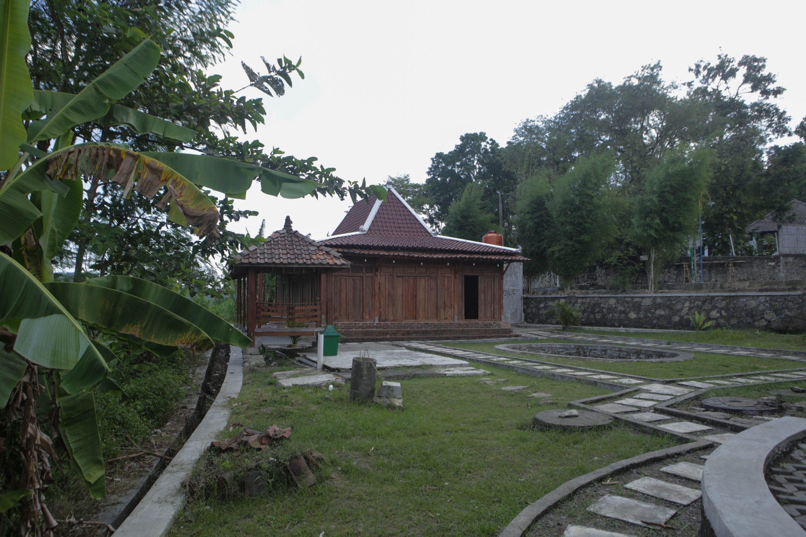
The village architecture also reflects the passage of time. Joglo and limasan-style wooden houses can still be found in several hamlets, standing alongside homes made from chunks of limestone. After the 2006 earthquake, many traditional homes were replaced by permanent concrete buildings. The changes in house design and materials are a trace of how the village has responded to disasters and the changing times.
In the midst of social, ecological, and economic transformations, Bangunjiwo remains a living space that constantly negotiates between the old and the new. It is a village that holds the memory of the past while facing the future, where residents continue to weave hope among the limestone hills, rice fields, and growing shadows of concrete.